Review, sync and deliver
Part 3 of 4 · Learning path · Sample counts
Start: the configured project, loaded while connected, with Quick Capture enabled. Finish: save and check delivery of NY-014; 37 → 38 sites, 49 → 50 project features.
Continue the night-mode field setup by taking an inspection from saved on the device to checked in the Geova backend, then preparing files for handover. The Mapplex demo workspace contains fictional sites, routes and service zones in New York, London and Tokyo.
This walkthrough uses actual application captures in night mode, with satellite imagery behind the capture and sync screens. Phone views lead each step; expand the tablet examples for more space. The offline exercise used a disconnected browser session with the project already loaded. It does not replace a field test on the intended phone, including offline startup and map availability.
Reading the screenshots
Original capture screens and downloads show this part's stage. Refreshed views may show the completed demo: 39 sites / 51 features. See why the counts differ. Select any image to view it at full size.
1. Save an inspection while offline
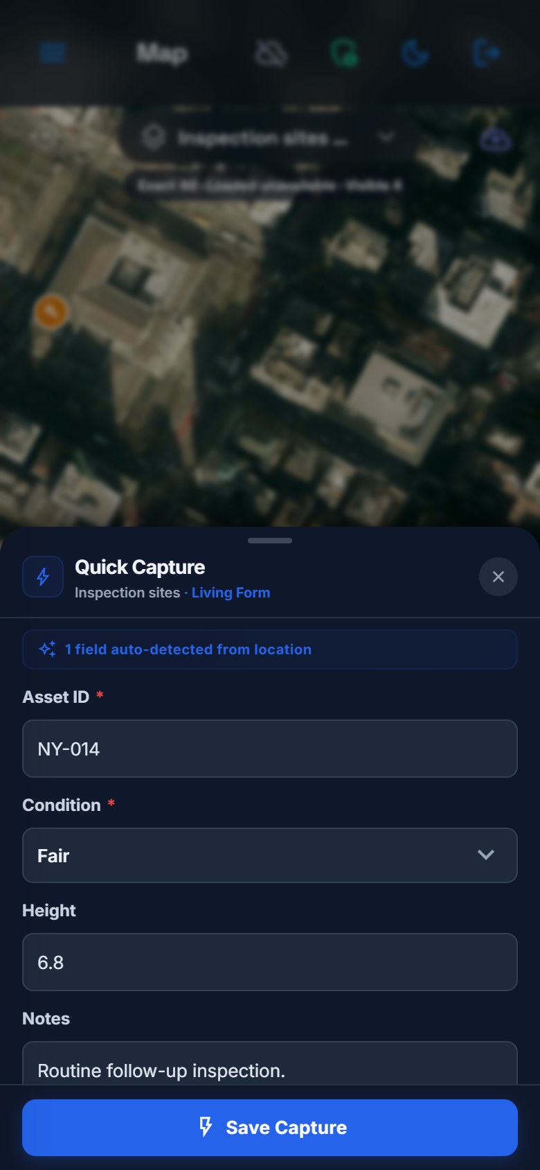
Open Global Field Operations, select the Inspection sites Point layer and check that Quick Capture is enabled. While connected, load the project and the area you need. Follow Prepare for offline work before leaving coverage.
For this training example, copy 40.7516, -73.9810, then choose Paste Loc on empty map space. If clipboard access is unavailable, enter the coordinate in the prompt. Review the pin and choose Confirm Location. This is a prepared location, not a measured GPS position. Enter the values below and review the location-derived Service zone.
| Field | Training value |
|---|---|
| Asset ID | NY-014 |
| Condition | Fair |
| Height | 6.8 |
| Notes | Routine follow-up inspection. |
| City | New York |
| Service zone | New York East |
| Inspection date | 2026-09-09 |
The NY-014 example in Part 2 was discarded. Here, a new NY-014 is saved at the coordinate above. If repeating the exercise, use a new identifier rather than saving another NY-014.
Disconnect the training device after loading the project, then choose Save Capture. Keep the local app data until delivery is confirmed.
2. Read the queue and confirm delivery
Open the sync-status control in the top bar. In Sync Inspector, check both Connectivity and Queued Changes. This example shows Offline and 1 queued standard change. An offline save is useful progress, but the receiving workspace cannot rely on it yet.
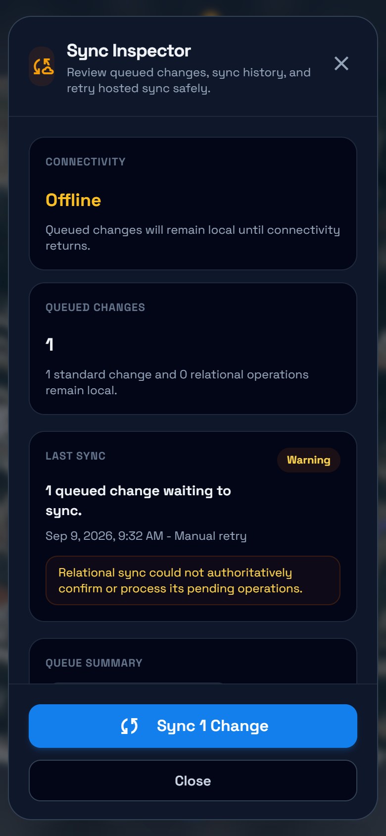
Restore the connection and allow hosted sync to run. If one eligible change remains queued, the inspector offers Sync 1 Change; the number changes with the eligible queue. Select it and read the result. Waiting to Retry or Review Changes Needing Attention calls for reading the accompanying message before retrying.
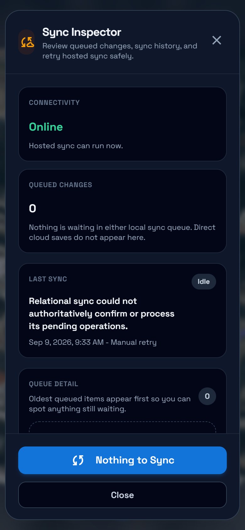
Reopen the inspector and check the record before handover. To confirm receipt in your own workflow, open the same hosted project on another connected device, allow it to refresh, and find the same Asset ID and reviewed values. Reopening the record only on the collecting device confirms its local copy. See Sync & recovery if receipt remains uncertain.
See the tablet mode view
Read the message as well as the count
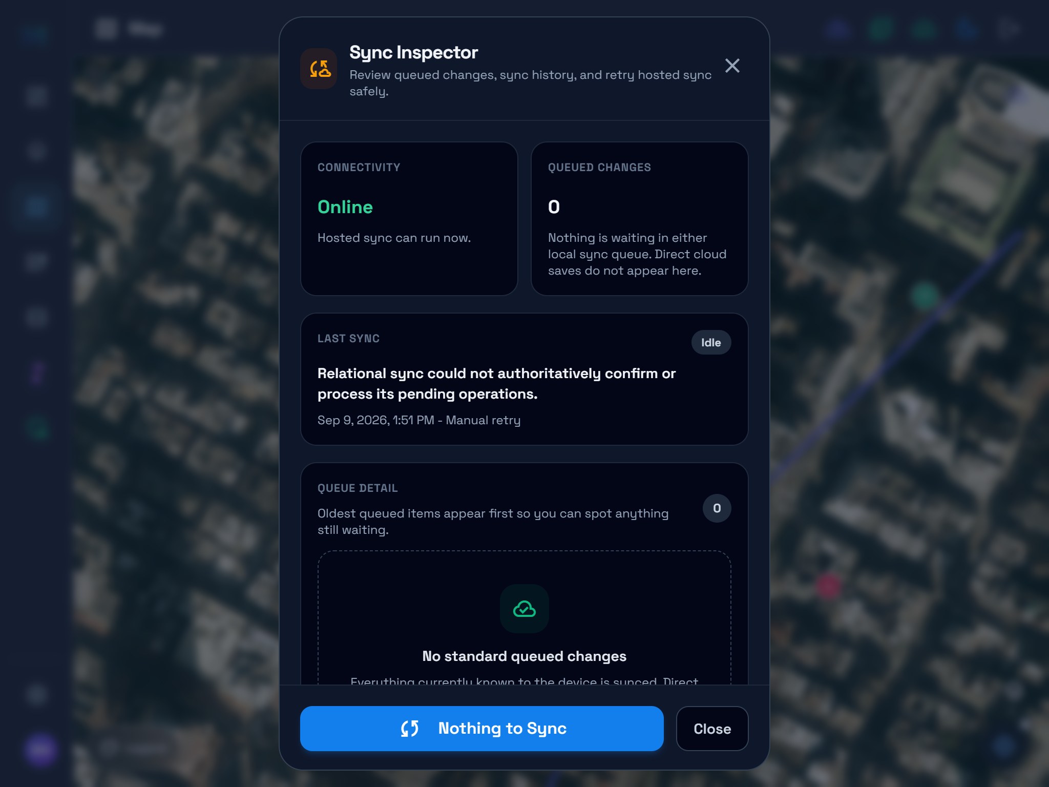
This session still reports that relational sync could not confirm or process its pending operations. Zero queued changes does not establish full sync health. The verified result here is delivery of one standard inspection. Related-data delivery was not verified; follow Check sync and recover saved work when that diagnostic appears. A completed export is also not proof of cloud delivery.
3. Review the saved record
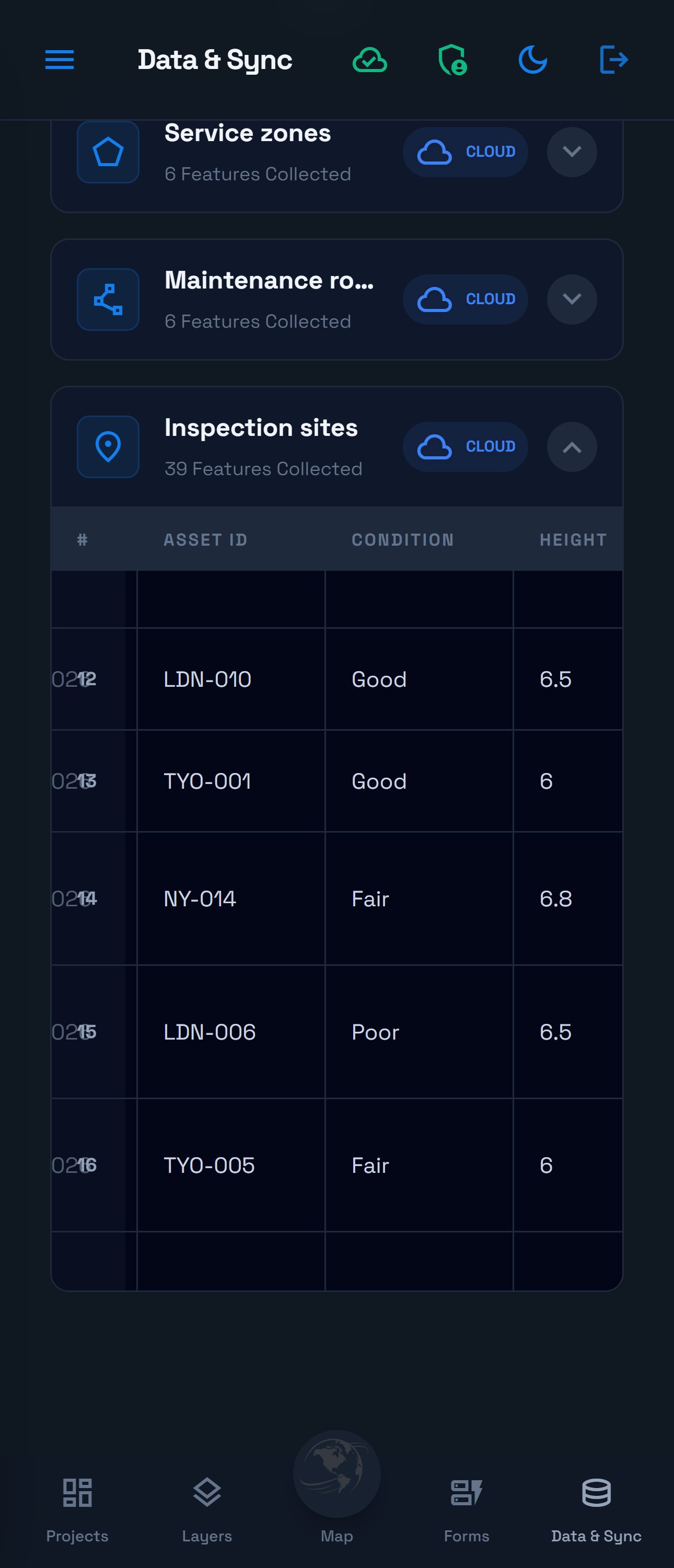
Open Data & Sync and expand Inspection sites under Collected Features. Find NY-014. Swipe the table horizontally to review its other fields; the tablet provides more columns at once. Check the record's identity, condition, height, city and service zone against the capture.
See the tablet mode view
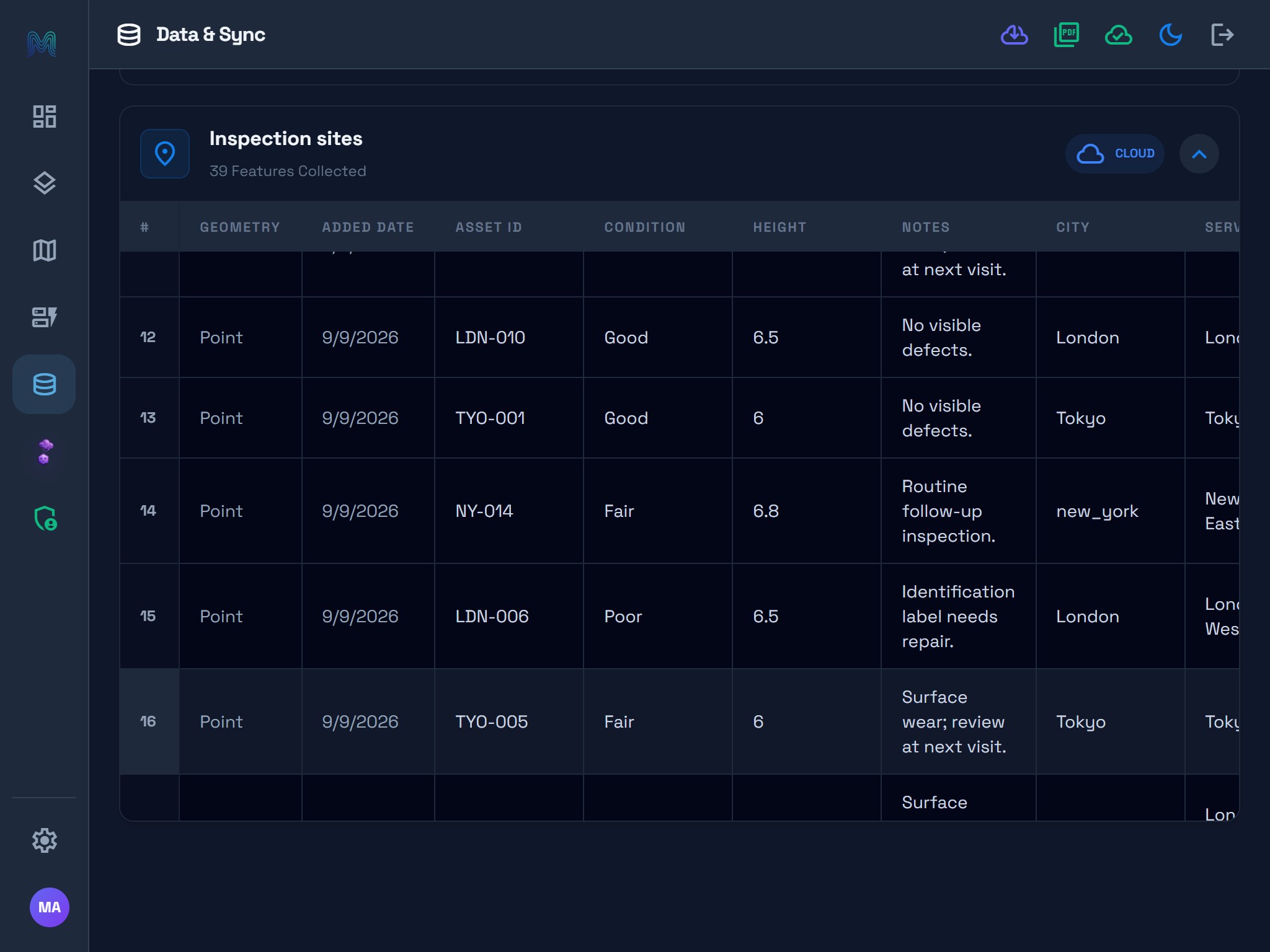
At the end of this part, the project had 50 features: 38 inspection sites, 6 maintenance routes and 6 service zones. The refreshed tables above also include the London site saved in Part 4, bringing the completed demo to 39 sites / 51 features.
City uses the Operating cities Lexicon. NY-014 stores new_york, while older records retain New York. Linking a Lexicon did not convert those older values. Review both forms of the value when filtering or preparing a delivery.
4. Choose the export scope
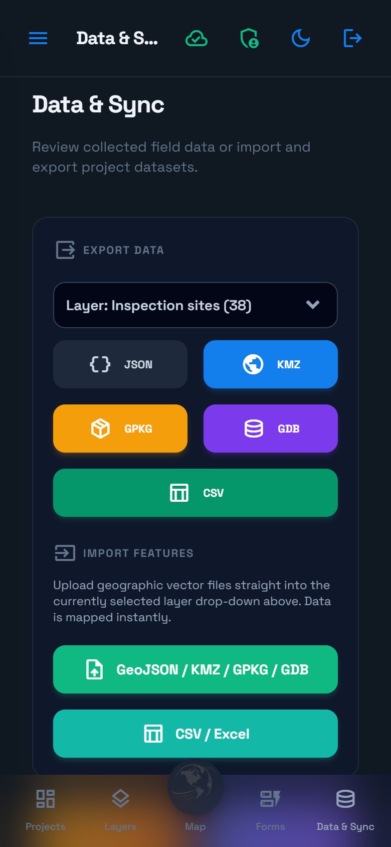
At the top of Data & Sync, use the dropdown in Export Data. Select Inspection sites for a site-only handover (38 at this stage, 39 in the completed demo), then choose JSON, CSV or KMZ. The export includes the selected dataset, independently of which table rows are visible.
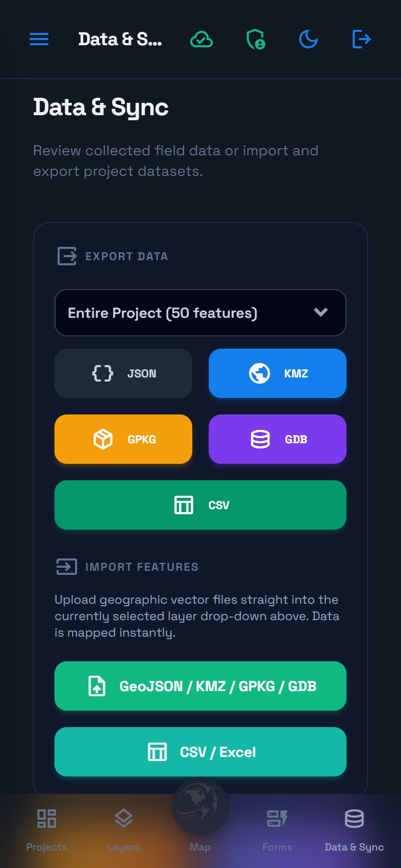
Choose Entire Project (50 features at this stage, 51 in the completed demo) when the recipient needs the sites, routes and zones together. In this example, use GPKG to prepare the full project package. Format access depends on the workspace's entitlements.
| Output produced in this walkthrough | Scope | Verified content |
|---|---|---|
| GeoJSON ZIP | Inspection sites | 38 point features and choice-list metadata files |
| CSV | Inspection sites | 38 rows, labeled fields, latitude, longitude and WKT geometry |
| KMZ | Inspection sites | KML with 38 placemarks |
| GeoPackage ZIP | Entire Project | 50 features in three EPSG:4326 layers, plus supported project and choice-list metadata |
The separate spatial reference source is not counted as another feature layer. A GIS package may contain additional metadata tables; those are not extra collected features. See Data & Sync for GDB conversion and other import/export routes.
5. Save and check the handover package
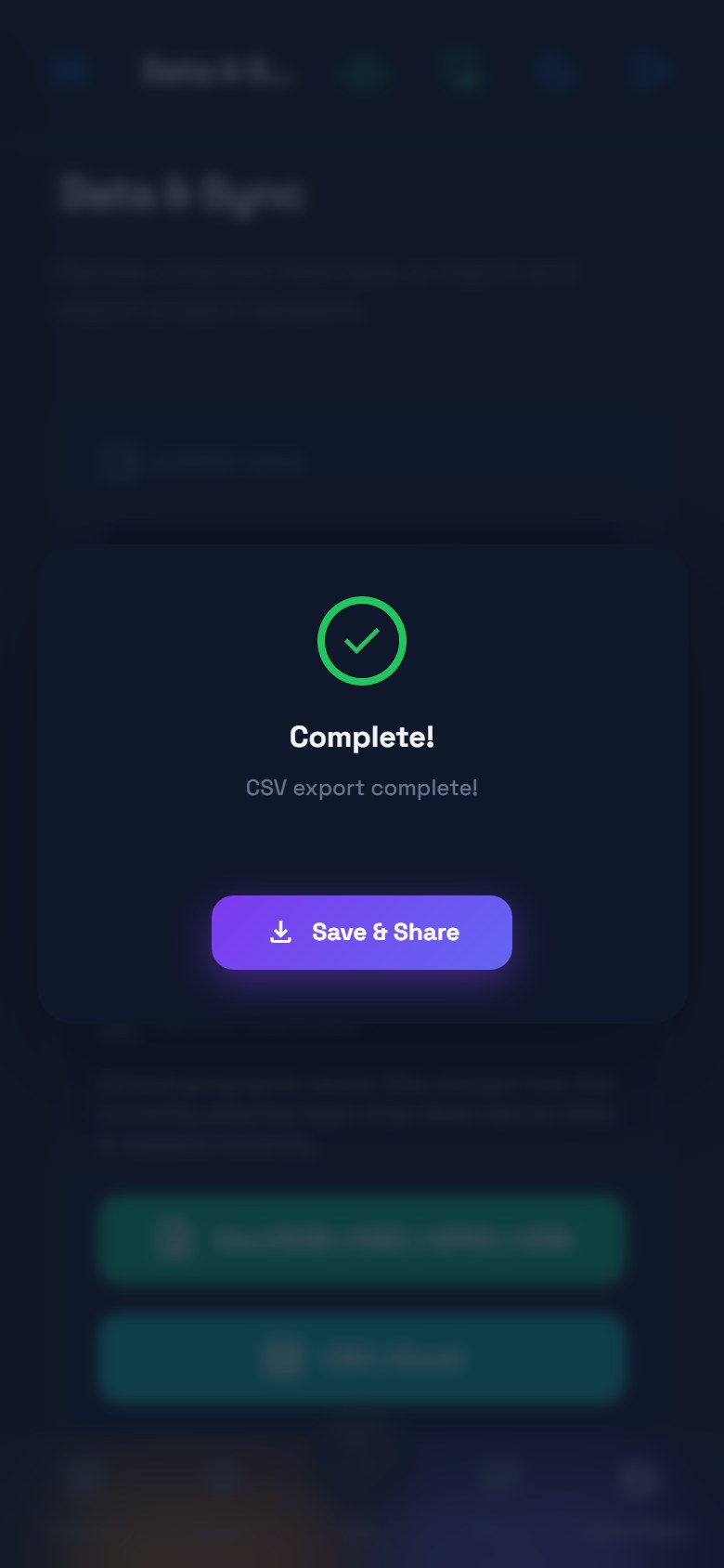
Wait for export processing to finish, then choose Save & Share when offered. Save the file to the intended destination using the device's download or sharing controls. A Complete! screen means generation has finished; it does not mean another person has received the file.
Download the four verified Part 3 sample exports. Extract this delivery bundle to find the individual files and its README. The app-generated packages are retained intact; the outer filenames have been made descriptive.
Why is JSON or GPKG inside a ZIP? Mapplex packages these exports when there are supported images or choice-list metadata to include. This project's Operating cities Lexicon adds a metadata folder beside the geographic file:
- mapplex_schema.json describes the exported choice lists and field bindings.
- arcgis_domains.csv lists domain values for a GIS setup workflow.
- arcgis_field_domains.csv identifies the fields to associate with those domains.
Extract the inner geographic file if the receiving application requires it, and keep the metadata folder with the original package. Changing a ZIP extension to .geojson or .gpkg does not convert it.
Before handing over, compare the expected count and check NY-014 at longitude -73.9810, latitude 40.7516. Its condition is Fair and height is 6.8. GeoPackage uses safe column names such as Asset_ID and Service_zone; GeoJSON and CSV use labels such as Asset ID and Service zone.
For CSV, WKT holds the geometry text. Importing only its latitude/longitude columns creates point locations; those columns are not a substitute for a line or polygon's full shape.
Check City codes before applying external domains
The current metadata exports the domain code New York, while NY-014's City attribute is new_york. Inspect and reconcile that mapping in the receiving workflow before enforcing a coded-value domain. The three metadata files do not automatically configure every GIS application.
These downloads were parsed and checked for record counts, NY-014 coordinates, metadata presence and GeoPackage integrity. External GIS display and a complete export-and-reimport cycle were not tested. Check any required attachments and relationships separately using the format preservation reference.
6. Prepare a nearby device handover
For supported mobile builds, Field Gathering (Local Sync) lets nearby devices exchange records on the same Wi-Fi network or hotspot. This is separate from exporting a file or delivering hosted work to the Geova backend.
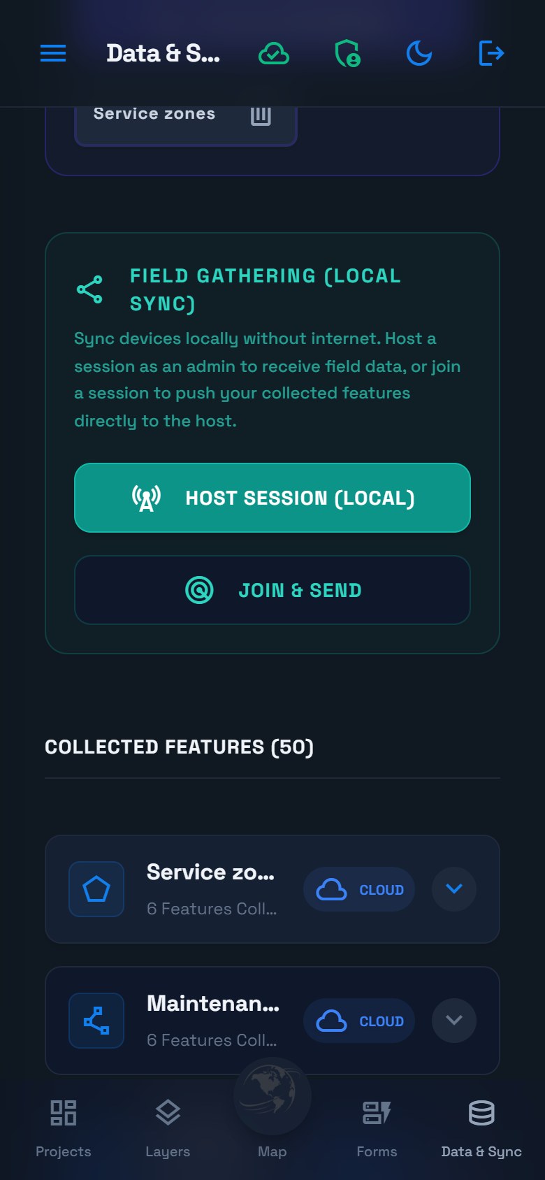
On the receiving device, start Host Session and wait for its ready status. On the sending device, choose Join & Send, enter the host's actual IP address, port and session code, then select the intended layer.
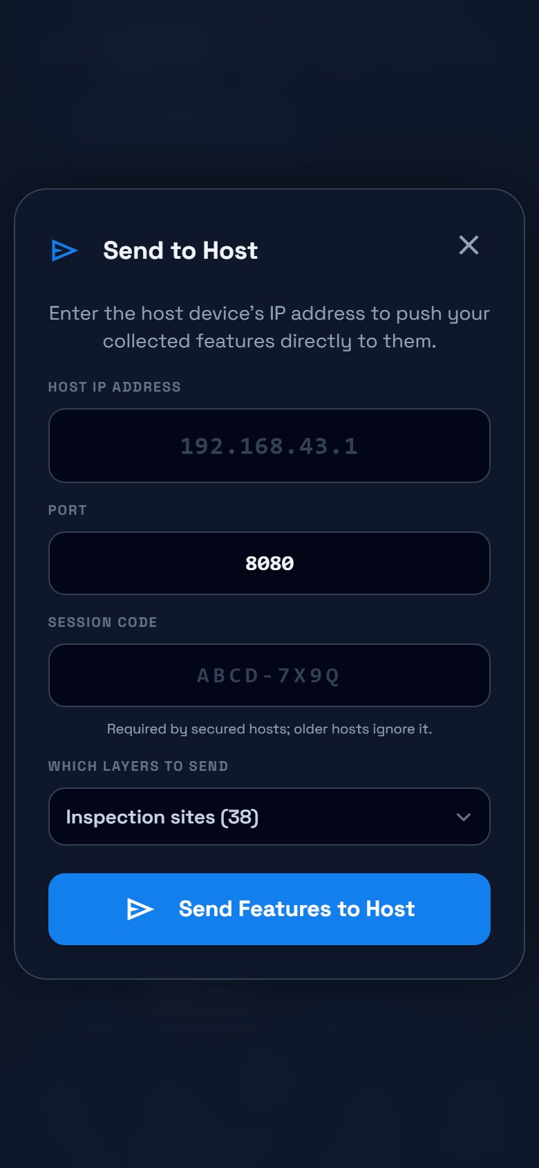
This walkthrough stops at the setup form. For an actual nearby-device handover, choose Send Features to Host, read the transfer result and check a known record on the receiving device. Keep the session open if a retry is needed. Confirm hosted delivery separately afterward, then stop the host session. Native local-network support and device permissions must be tested on the field devices. Follow Field Gathering instructions for the complete procedure.
7. Review team activity
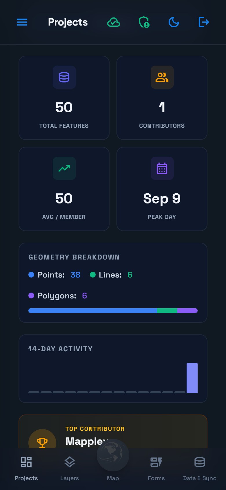
Open Projects → Team & Shared → Performance. Review the date range before interpreting the totals, geometry breakdown and contributor activity. The original phone capture shows 50 total features and 1 contributor, Mapplex. The refreshed tablet capture includes the later London inspection and shows 51 features, still with one contributor.
See the tablet mode view
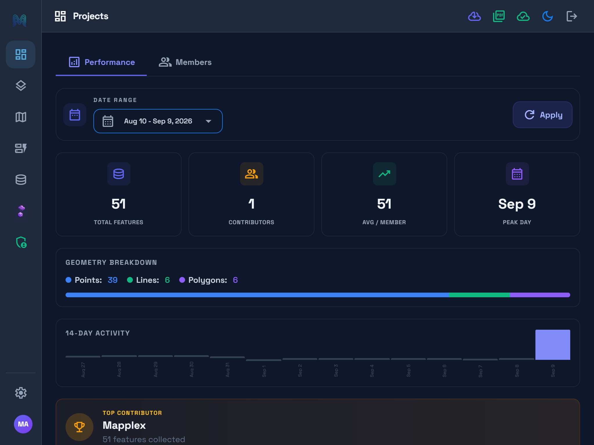
A useful review connects these totals to the actual records and unresolved delivery messages. A contributor count or chart does not confirm inspection quality, positional accuracy or complete synchronization.
8. Review membership before inviting
Under Team & Shared, open Members. The current workspace contains Mapplex (You) at dem@geova.net, with the Owner role. This is the actual demo roster; additional inspectors have not been created for the images.
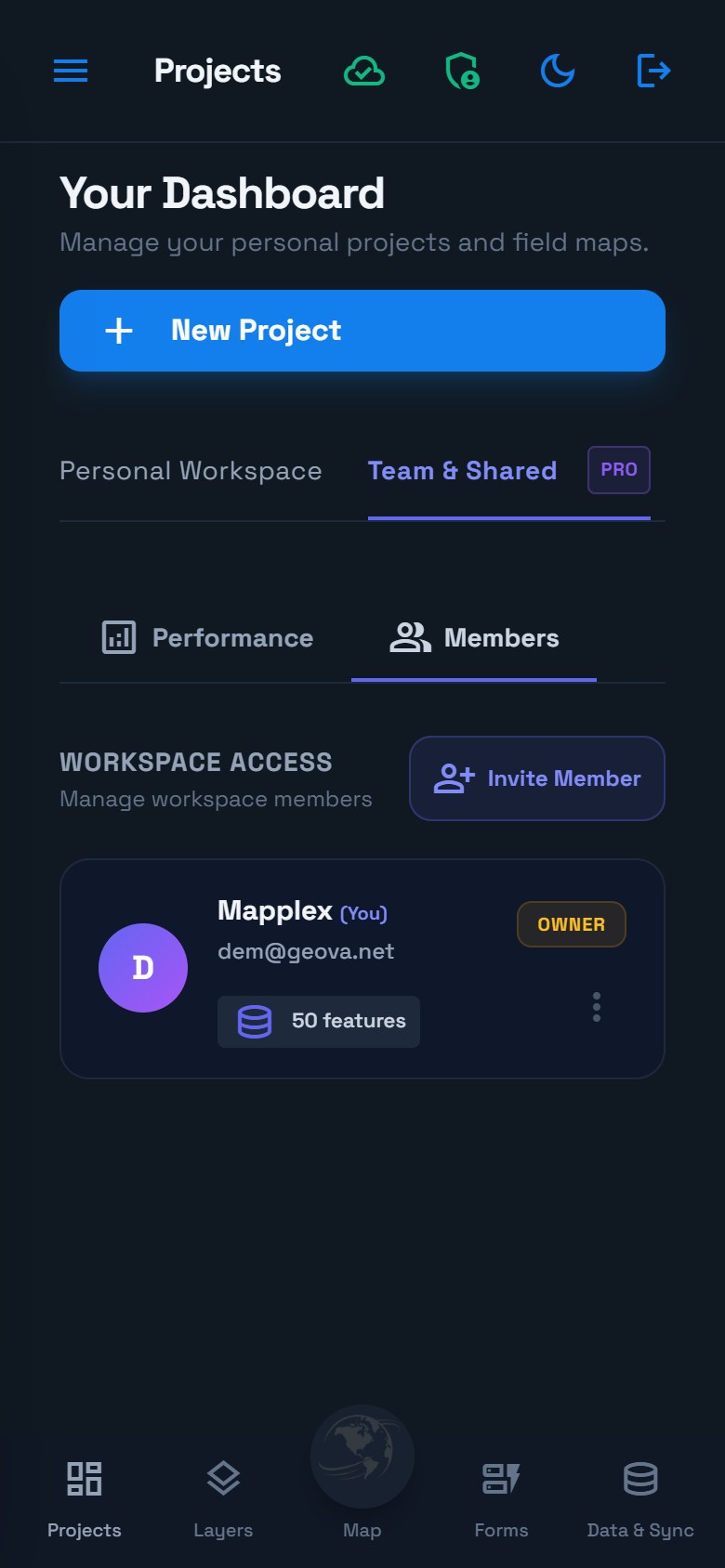
For this practice, choose Invite Member to inspect the available roles, then Cancel. For a real invitation, enter the intended address and review Assigned Role. The current picker offers Collector (Data Entry), Editor (Review & Edit) and Admin (Full Control). Select the role needed for the person's work and check the relevant access requirements.
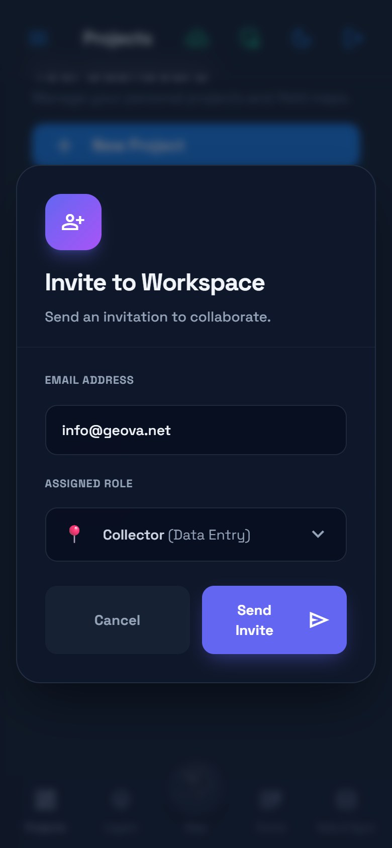
For a real onboarding task, verify the address and role before Send Invite, then follow the invitation status and confirm the recipient's access. Workspace membership and the scope of an individual project should both be reviewed when planning shared work.
For delivery details, see Data & Sync.
Before you continue
NY-014 is saved and its delivery has been checked. This stage has 38 sites / 50 features; the original exports use those counts. Next, switch to standard capture for the London inspection.
Previous: Part 2 · Night-mode field setup · Learning path & counts · Next: Part 4 · Standard capture, CAD and SHP