
01
For organizations
Connect your field and office.
Bring maps, structured data, analysis, field observations, and project delivery into one working process with Mapplex.
Explore MapplexGeova / Spatial intelligence
Mapplex · Geova Portal · Geova AI · RoadPlexGIS software and custom systems for teams whose work depends on location.
Geova makes Mapplex for maps, data, analysis, and fieldwork, Geova Portal for maps on the web, and Geova AI for questions about your own data. When a process needs more, we build the system around it.
Software + spatial expertise
Mapplex is where a team maps, captures, and analyzes. RoadPlex turns road video into reviewed findings on the map. Geova AI answers questions from the records you are authorized to see. This illustrative film follows one workflow through a system built around an organization’s work.
Build with GeovaPhone / Dark mode
Bring your field records onto the map and use satellite imagery to understand the area around each asset.
A saved field asset in London. Open its marker to review the record.
Explore the workflow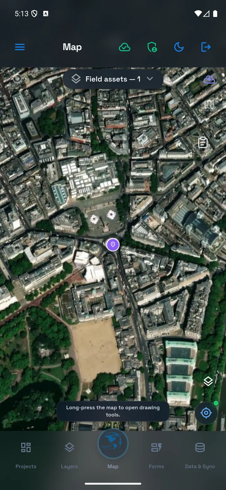
Where to start
Choose the place that matches your work.
For organizations
Bring maps, structured data, analysis, field observations, and project delivery into one working process with Mapplex.
Explore MapplexFor professionals & project teams
Create maps, work with data and forms, investigate questions, and prepare useful outputs. Take supported work offline when the task moves into the field.
Read the Mapplex user guideFor custom projects
We build the system around your data and your process, using our GIS and engineering experience.
Explore custom systemsGeova AI / Built to connect
Explore possible workflows for excavation requests, demolition management, and other custom systems. Geova defines the features, integrations, and permissions around each project; the examples below illustrate that approach.
Your data, people, and processes
Web, mobile, and operational workflows
Example application. Connect proposed work areas, request information, spatial checks, and review steps within an application developed by Geova.
Discuss your systemGeova AI / Context matters
Count sites by zone, explore distances, or ask about overdue work in Mapplex. Review the source data, method, and scope shown with the answer before deciding what to do next.
Meet Geova AIWhich Work Orders are overdue as of 2026-09-20?
LDN-01 · Cabinet inspection. In progress, high priority, due 19 September 2026. The answer reads authorized saved records; it does not change the assignment or progress.
Fictional project example · Due dates compared with 20 September 2026, Europe/London, using the records’ saved status.
A wider spatial toolkit
From a project idea to the quality of a point on the ground, Geova’s tools support more of the work.
Design layers, forms, tables, relationships, and rules. Refine the plan, review permissions and assumptions, then confirm creation where execution is enabled.
External receiver integration, capture quality checks, and survey evidence. Availability depends on validated hardware and an enabled deployment.
Combine a short series of stationary phone GNSS observations and review the resulting position and quality evidence. Results depend on the device and conditions.
Calibrate the sensor, record slope stations and distances, and inspect the estimated height profile. Resume a paused session before continuing observations.
Explore proximity, buffers, joins, filters, measurements, and other spatial operations in the context of your data.
Prepare map PDFs and engineering drawings. Use CAD Manager for DXF and SHP Manager for Shapefile exchange; other formats depend on the selected workflow and access.
Feature access varies by workspace and release. Phone positioning and sensor-based profiles do not imply survey-grade accuracy.
Explore the tools with usLatest product update