Your first field project
Follow one small inspection project through Projects → Layers → Forms → Map → Data & Sync → Geova AI. Each step ends with a check, so you can confirm the result before adding more data.
The screenshots show the current phone interface in night mode, with satellite imagery on the map and expandable views of the actual tablet interface. The Mapplex demo account uses a separate Field practice local project with the two fictional records in this exercise. These are prepared training examples, not surveyed assets. The form and data-table phone images use the larger 430 × 1000 viewport at three-times pixel resolution. Select an image to open it at full size.
Before you start
- Open the approved Mapplex application and check access requirements.
- Use Local (Offline) for practice on one device, or an authorized hosted workspace if you want to test Geova Cloud delivery.
- You need layer/form management access for setup. A collector can follow the field quick-start once the project is prepared.
- This exercise uses ordinary fields and a manual dropdown. Shared Lexicons, Smart Logic, and Geova AI are optional additions with separate access requirements.
- Use two practice locations you can identify. Allow device location access only if you choose GPS capture.
- For the regular form workflow here, leave Settings → Field tools → Quick Capture Mode off. You can practise Quick Capture separately in the global walkthrough.
Practice outcome: two Inspection sites records, one Good and one Poor, with a checked export. Hosted sync and AI review are additional checks when available.
1. Create the project
- In Projects / Dashboard, choose New Project.
- Enter Field practice as the project name and a short description.
- Choose Local (Offline) for the basic exercise. Choose Hosted (Cloud) only when signed in and using the intended workspace.
- Leave initial-data import empty and select Create Project.
- Wait for the project card, then use Activate if the card is not already Active.
Check: the project name and storage badge match your choice. A local guest project remains on the current device; it does not sync to Geova Cloud.
See Projects & dashboard for storage choices and uploading a local project later.
2. Add a point layer
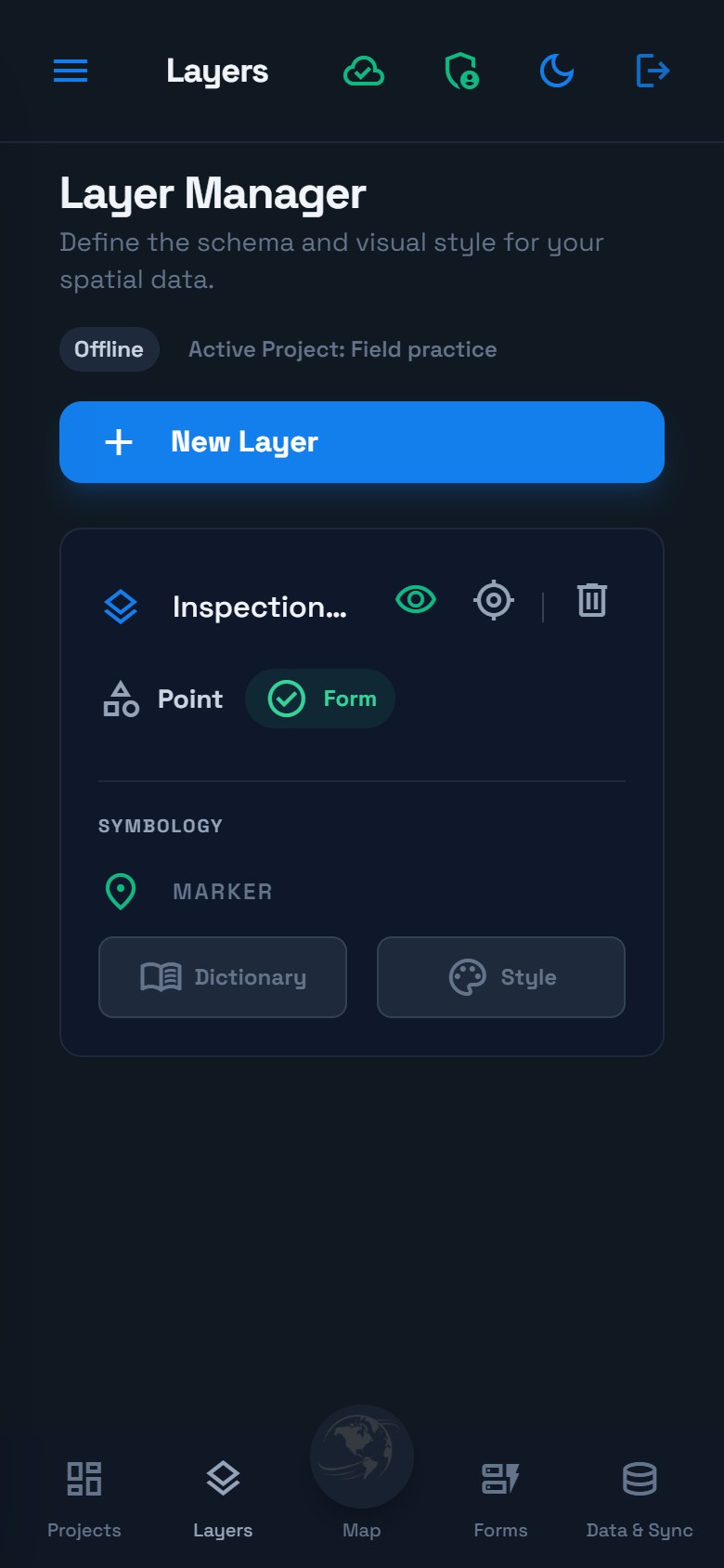
- Open Layers, select New Layer, and name it Inspection sites.
- Choose Point and a recognizable marker color/icon.
- Select Create Layer.
- Check the layer card, then continue to Forms.
See the tablet mode view
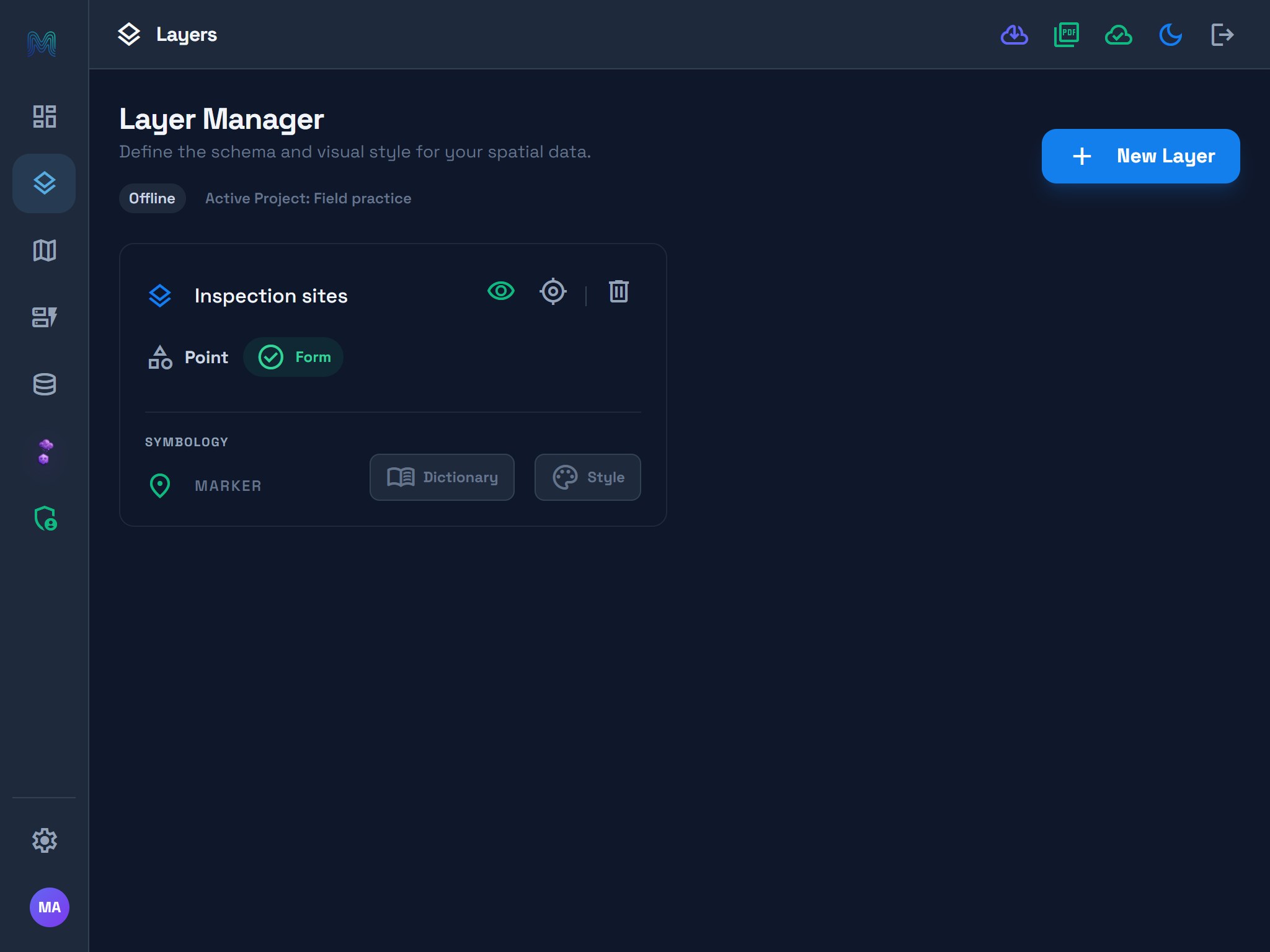
Read the card: the name activates the collection layer; the eye changes visibility; the zoom control finds its extent. Style controls appearance and Dictionary describes field meaning. Showing a layer does not select it for collection.
3. Build a short form
- Open Forms and choose Inspection sites from the layer selector.
- Use Add Field to create these fields in order.
- For Condition, enter the manual choices Good, Fair, Poor.
- Wait for Saved on device. If the status includes Sync queued, confirm delivery before using the revised form on another device.
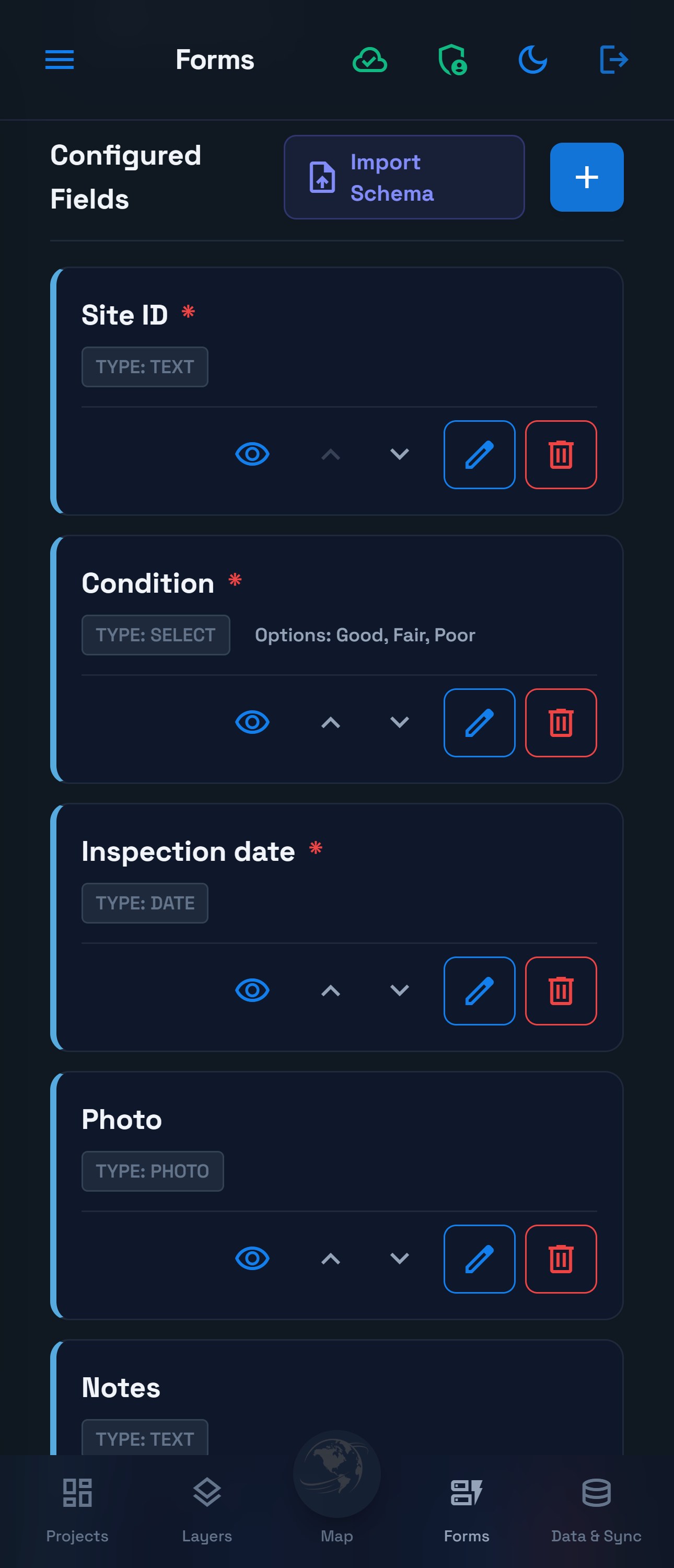
| Field | Type | Required for this exercise? | Example |
|---|---|---|---|
| Site ID | Text | Yes | P-001 |
| Condition | Dropdown (Manual Options) | Yes | Good, Fair, Poor |
| Inspection date | Date Picker | Yes | The day of the visit |
| Photo | Photo (Camera) | No | A suitable practice photo |
| Notes | Text | No | A short observation |
See the tablet mode view
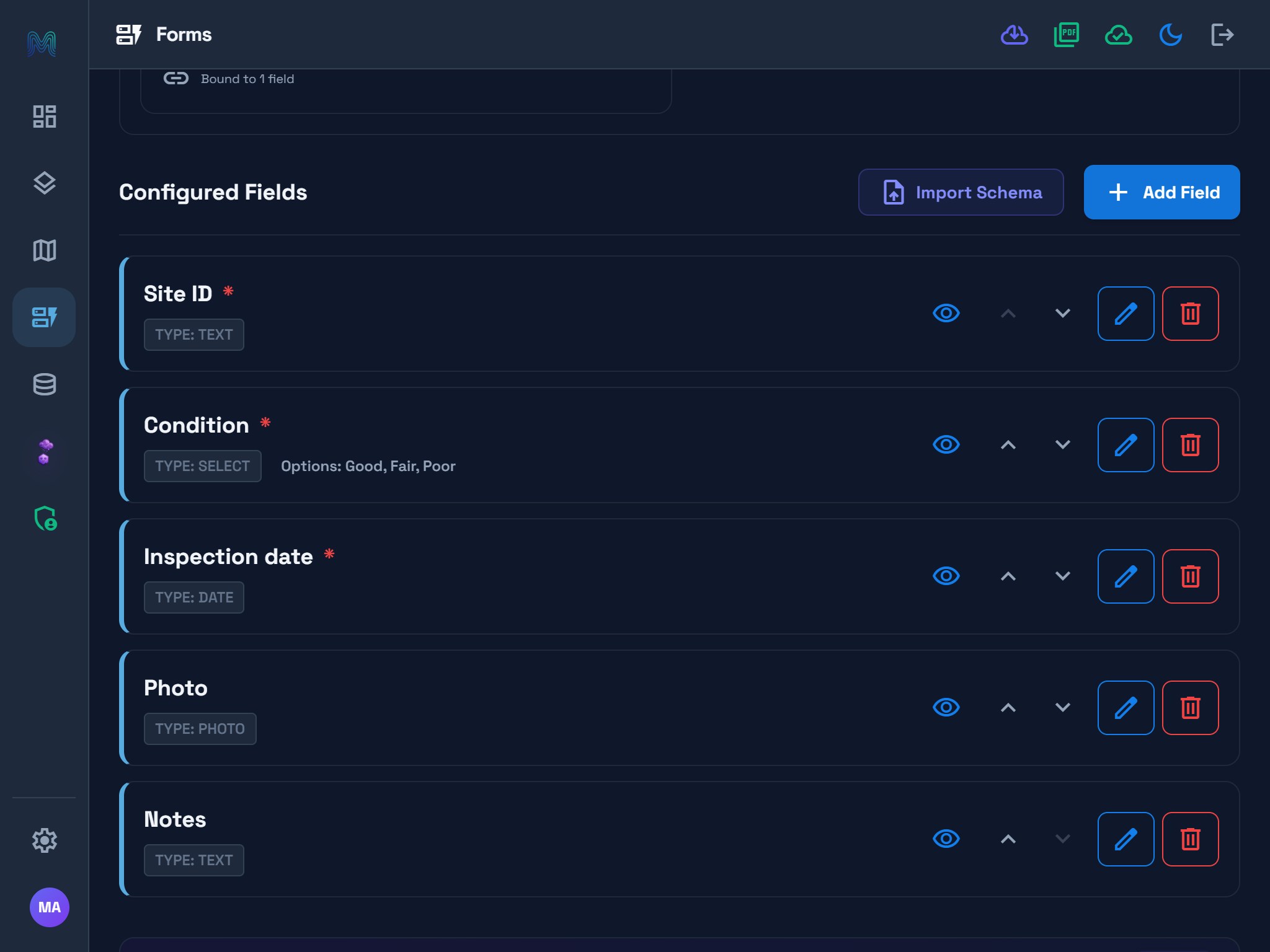
Use the layer selector before editing. The field cards show type, required status, visibility, order, and edit/delete controls. A locked Lexicon or Smart Logic panel indicates separate access; the manual-dropdown exercise can continue.
Check: reopen the selected form and verify its labels, choice values, and saved status. If a save fails, stay in the builder and retry after resolving the issue.
Optional improvement: Show Notes only for a poor condition, or calculate an estimated cost. Test both sides of each condition. For this first exercise, keeping the basic form visible makes its behavior easier to follow.
4. Collect one record
- Open Map and check that Inspection sites is the active layer.
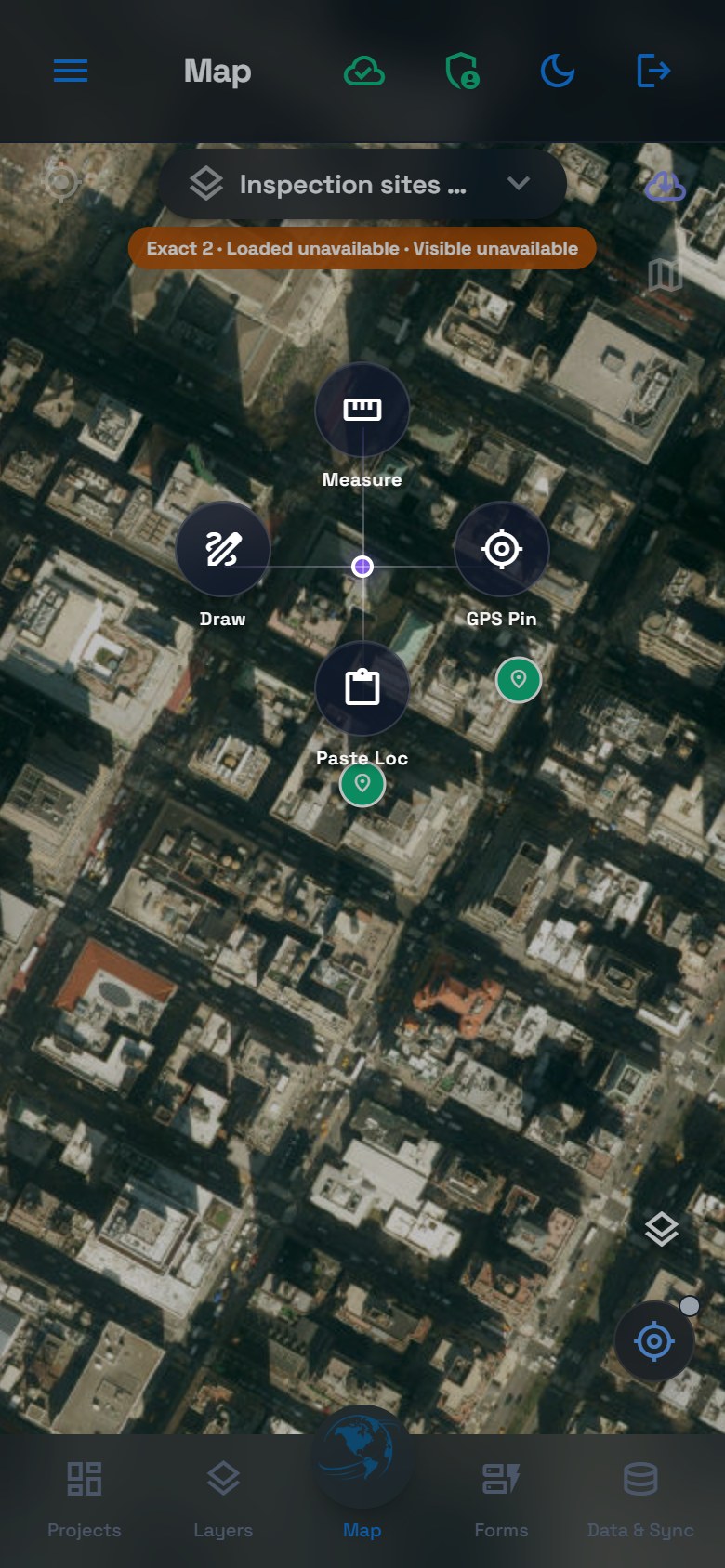
- With the default radial controls, long-press empty map space on touch or right-click on desktop, then choose Draw.
- Tap the first practice location. If a Precision crosshair appears, position the map under it and use Add Point; follow the Precision steps.
- Complete the form: Site ID = P-001, Condition = Good, and the inspection date. Enter No action needed in Notes; attach a photo if useful.
- Save, then reopen the feature and check its position and values.
See the tablet mode view
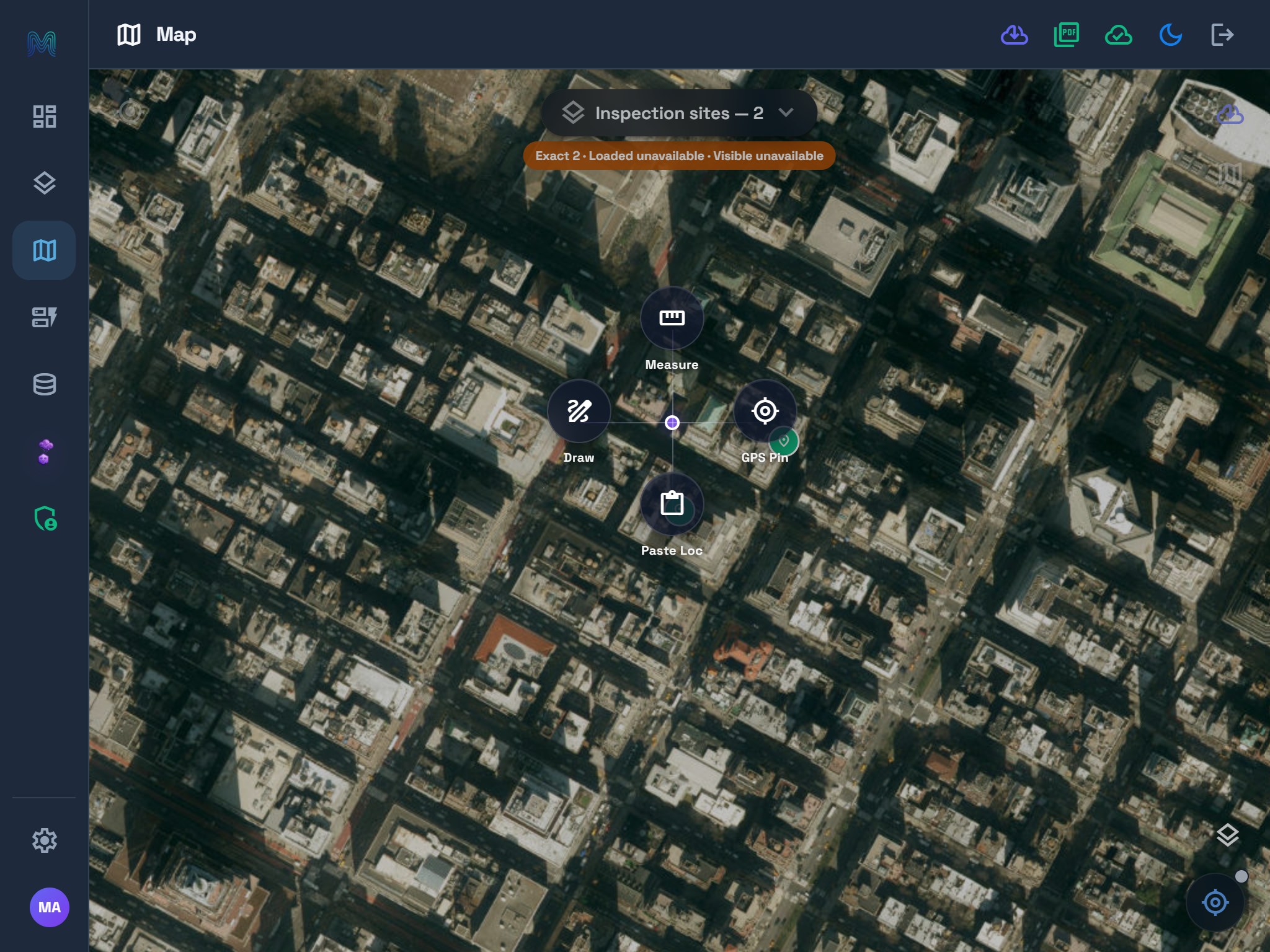
Check the active layer at the top. Opening this menu starts no record; choose Draw, position the geometry, and complete the form. The example reports unavailable loaded/visible counts; the menu is not evidence of complete map coverage. Verify records in Data & Sync when those counts are unavailable.
For GPS collection, use GPS Pin, review the temporary pin, and confirm the location before completing the form. See Phone positioning for ordinary and enhanced capture.
Add the second practice site
Repeat at another location using P-002, Poor, the inspection date, and Identification label needs repair in Notes.
Check: you can reopen two distinct sites and identify which one needs attention. Finish the collection session by returning the map to idle; drawing can remain active after saving. Precision can require one Cancel to leave the crosshair before another Cancel exits the task.
Two sample points are two assets. To record another visit to the same asset, follow Record repeated inspections where enabled instead of creating another asset point.
5. Review and export
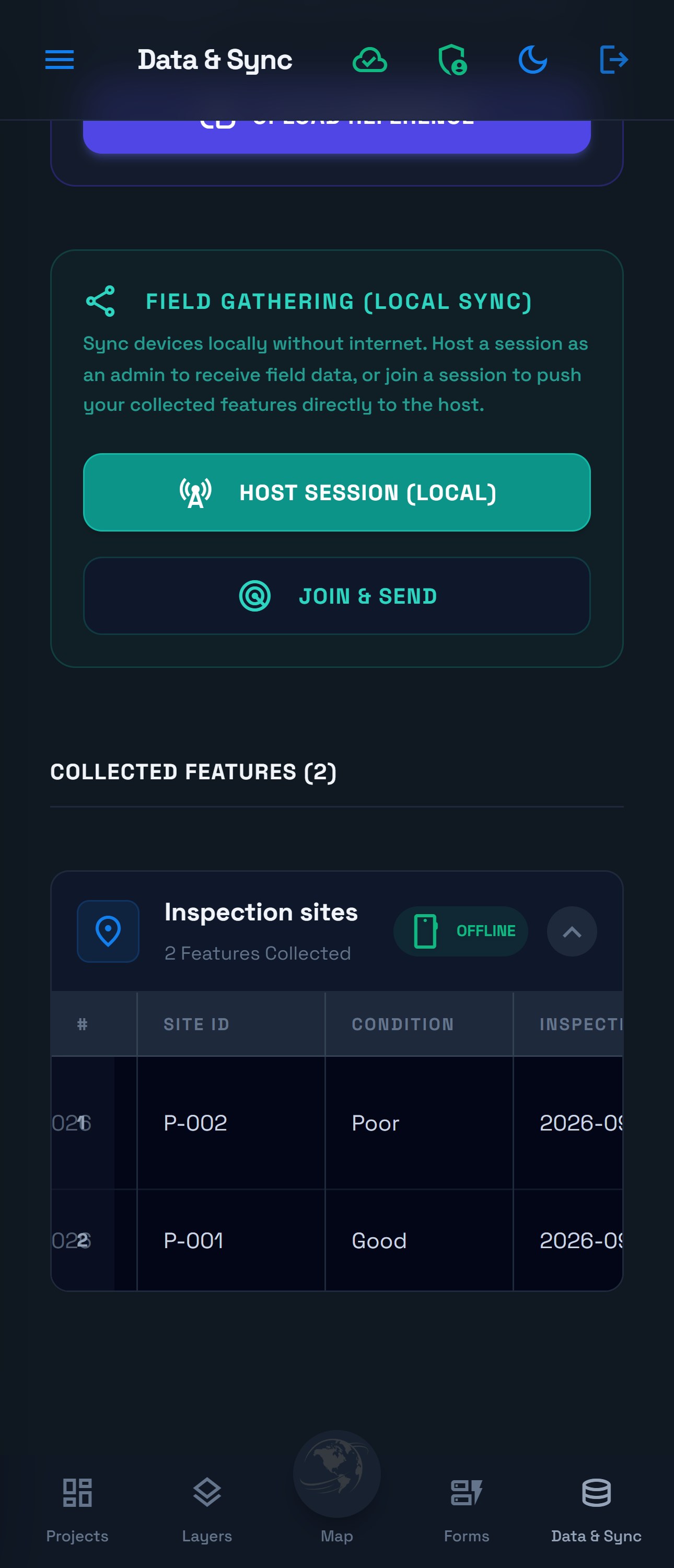
Open Data & Sync and expand Inspection sites. Confirm the count is two and compare Site ID, Condition, date, and Notes with your entries.
See the tablet mode view
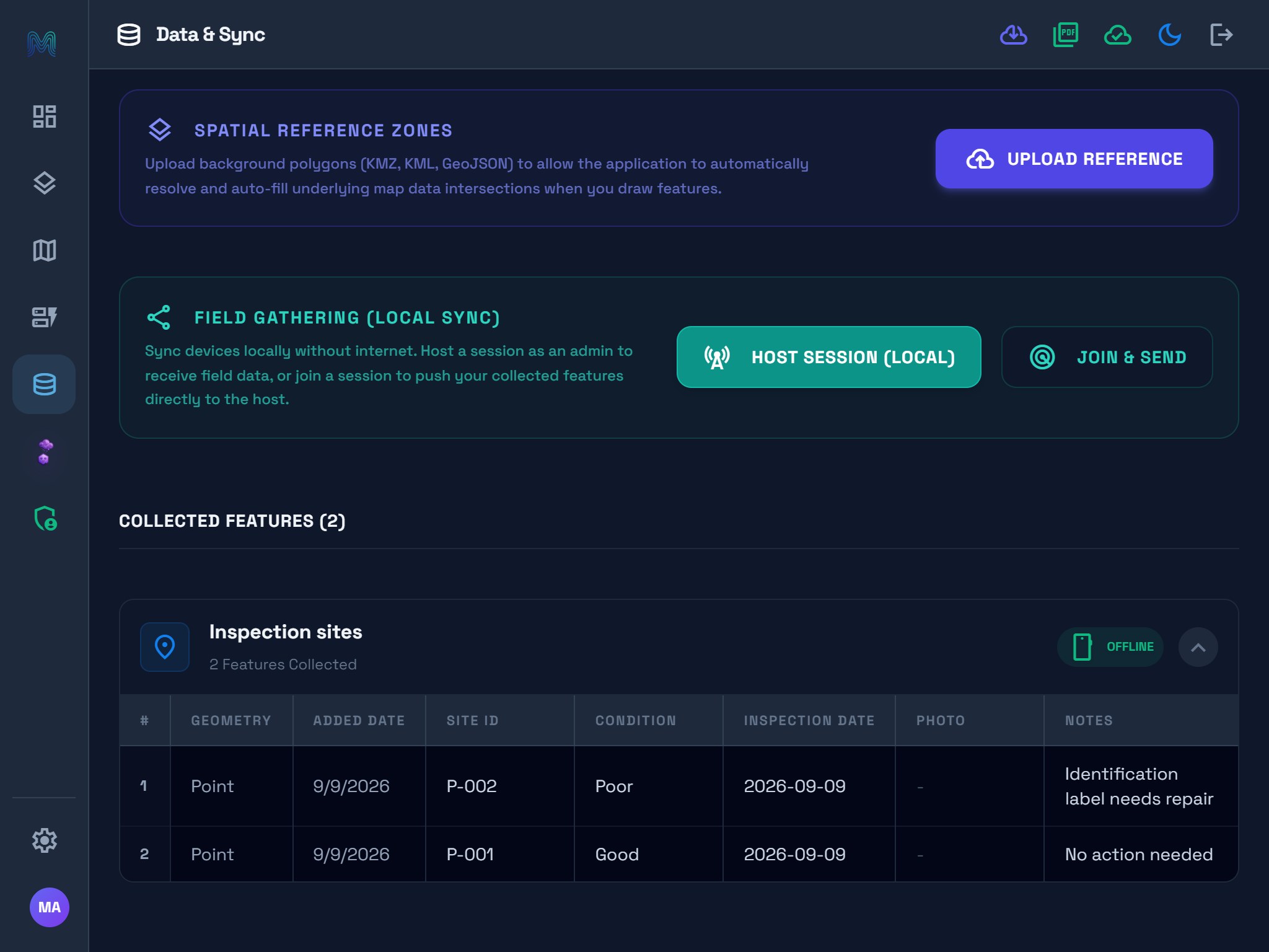
The layer card count describes the dataset. Its table loads records in pages; opening the table does not select the export scope. CLOUD/OFFLINE describes the storage source, not delivery status.
Check delivery for your storage choice
- Local project: keep the records on this device and prepare a checked file handover.
- Hosted project: open the main sync-status control. Review pending work and its result before handover. Use sync recovery if delivery needs attention.
- Nearby transfer: Host Session and Join & Send transfer to another device. Verify receipt there; Geova Cloud delivery is a separate check.
Export a sample you can verify
- In the dropdown above the import/export controls, choose Inspection sites.
- Choose JSON (GeoJSON) for geometry and attributes, or CSV for a spreadsheet review.
- Wait for the download or sharing action offered by the app.
- Open the result in the receiving tool. Confirm two records, the Good/Poor values, and the expected positions or coordinate columns.
Photo and related-record preservation depend on format. Choose the required format using the preservation reference; a CSV is not a complete project backup.
6. Review with Geova AI, when available
This step requires a signed-in session, Geova AI access, network connectivity, and workspace credits. You can finish the basic local exercise without it.
- In the intended project, open the phone menu and choose Geova AI Partner, or choose Geova AI from the tablet side rail.
- Use the mention pickers to ask Show records in @Inspection_sites where #Condition is Poor. Select the actual layer and field names offered by your project.
- Review the result scope, count, evidence, and SQL when shown. If your layer contains exactly the two practice records above, one Poor record is expected.
- Use Preview to inspect the result on Map, or CSV to export that result.
- If you need a saved result layer, select Add to Mapplex, enter a name, and review Confirm AI Layer Creation before confirming.
An exact answer of zero can still be a validated technical answer. A validated technical answer costs one workspace AI point. Preview does not save a layer, and temporary result data may expire. See Geova AI result controls, or follow the illustrated global AI review for verified counts and summaries.
Expected result
You have one project, one Point layer, a five-field form, two reviewed records, and a sample export you have reopened. For hosted work, you have also checked delivery. If you used Geova AI, you can explain the answer's scope and distinguish its preview from a saved layer.
If something does not work
| Issue | What to check |
|---|---|
| Project or layer creation is unavailable | Active workspace, role, storage choice, and enabled capabilities |
| Form shows no fields | Choose the intended layer; verify its last saved form |
| A save does not complete | Required answers, valid choices, rule conflicts, and the actual error |
| GPS cannot supply a usable location | Device location permission and the positioning guidance |
| Saved features remain red | Completion checks all eligible visible fields, including optional ones; red is not a sync failure |
| A record is absent from the table | Project/layer, loaded pages, available local data, and sync state |
| Export has unexpected records | Check the export dropdown; table expansion does not set the scope |
| AI is unavailable or returns an unexpected answer | Access/credits/connection, the mentioned layer, choice values, and response scope |
Use the field quick-start for daily collection, offline preparation before leaving coverage, or the fuller municipal inspection walkthrough.